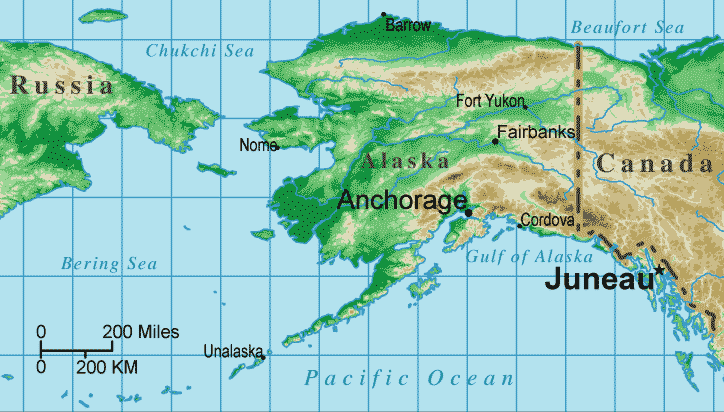
Alaska Topographical Map
United States Map > Alaska > Interactive Map
The State of Alaska
The Alaska map includes only the state of Alaska. The state capital shown on this sectional United States map is Juneau.

Alaska Map Legend


Alaska is mountainous, especially in the southeast, while much of the north is tundra and Arctic permafrost. Mount McKinley, the highest peak in North America, is located in the Alaska Range which rises between Anchorage and Fairbanks. Much of central Alaska is drained by the Yukon River.
Note that, on this cylindrical projection map, the scale is true only at about the latitude of Juneau.
Interactive Alaska Map
United States Topo Map Menu
| Detailed Topographical Maps of United States Regions | |||||
|---|---|---|---|---|---|
| Alaska | Northwest | Northern Rockies | Northern Plains | Upper Midwest | Northeast |
| Far West | Central Rockies | Central Plains | Midwest | Middle Atlantic | |
| Hawaii | Southwest | Southern Rockies | South Central | Deep South | Southeast |
Copyright © 2006-2025 United-States-Map.com. All rights reserved.